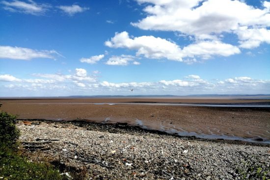
A new £11m coastal defence scheme designed to help protect east Cardiff from flooding has been discussed by the Council’s Cabinet at their meeting on the 15th March.
The Council agreed to tender for a design and build contract for the coastal defence scheme.
Currently 249 residential properties and 3 non-residential properties have been identified as at risk of flooding in a report which says the coastline parallel to Rover Way has erosion rates comparable to the highest in Europe.
The Cabinet Member for Clean Streets, Recycling and Environment, Cllr Michael Michael, said:
“A report into the current state of defences along the foreshore by Rover Way makes it clear that they are in a poor condition and only have a short to medium-term lifespan. Based on predicted erosion rates and taking into account predicted sea level rise, the coast off the west of Rhymney river will continue to erode with 30m of retreat predicted by 2036, 50m by 2067 and 170m by 2117.
“This would lead to the loss of Rover Way Travellers’ site and the adjacent electrical substation within five years and the release of large volumes of unknown tip material from the Frag tip into the Severn Estuary. The report also points towards a potential breach being established in the defences east of Rover Way Travellers’ site, resulting in flood risk to significant areas of land including Rover Way itself, Tremorfa industrial estate, some residential properties, local amenities and a supermarket.”
The business case for the coastal defence scheme has produced costings of £11m. Welsh Government would contribute £8.25m from the Coastal Risk Management Programme and the Council would be expected to find £2.75m.
The current proposal contains a range of benefits including:
- Managing flood risk in the area over the next 100 years for 1,116 residential and 72 non-residential properties;
- Preventing the landfill site from eroding; and
- Protecting roads and the Rover Way Travellers’ Site.
Cllr Michael added:
“This scheme has to be forward thinking and has to take into consideration both the coastal path that runs along this area, as well as future Welsh Government plans for the final phase of the Eastern Bay Link Road
“We have carried out an assessment on seven different schemes and we now have a preferred solution. A wall of boulders – known as rock armour – will be built along more than 2,000 metres of the coastline running parallel to Rover Way, as well as on the coastline in front of the landfill site. This technique will also be used to stop further erosion to Lamby Way Bridge.
“The embankment will then be raised on 1,320 metres of coastline around the Rhymney River Motorboat Sail and Angling Club on either side of the river, with a metal wall – known as sheet piling – built further inland on 610 meters of coastline along Lamby Way roundabout.
“We will also need to ensure that once the detailed design of the scheme has been completed we re-assess to confirm it can be built within budget and is fit for purpose.”


